Explore Himalayas, Nepal: Mount Everest Basecamp Trek
The trip of a lifetime
26 min read
Overview
Distance: 100 km (approximately)
Average Duration: 14 Days (Can also be completed in 12-15 days)
Difficulty Level: Intermediate
Total Elevation Gain: 2,600m (approximately)
Start/Finish: Kathmandu– Kathmandu
The Everest Base Camp trek is a challenging yet rewarding 14 day journey through the Khumbu Valley in Nepal, leading to the foot of Mount Everest, passing through Sherpa villages, crossing suspension bridges, and offering breathtaking views of the Himalayas. Included in this blog are answers to FAQ's such as, how high is everest base camp? What is the mount everest base camp cost? and a recommendation for the best everest base camp trekking companies.
Planning
Getting There: We began our tour from Kathmandu. From Kathmandu we flew to Lukla airport, and the hiking began. There are other start and end points, but this is the most common.
Season: March to May or late September to November (to avoid monsoon season)
Permits & Fees: There are permits and fees, these will be included in most tour costs. Insurance is also mandatory due to the amount of hikers requiring helicopter rescue.
Water: Water is available to purchase almost everywhere. The price increases as you climb higher (because the yaks have to carry it further) I used water treatment tablets without any issues.
Food: My food was included with the tour. I just took snacks. Food will also be available along the way if you require more or want additional snacks.
Accommodation
You’ll likely be staying in tea houses. As I was with my girlfriend, we shared a room by ourselves every night. Accommodation was covered with the tour.
I did notice people camping in tents. These were large groups and they appeared to be well equipped to handle the elements.
Introduction
My girlfriend had told me stories of an attempt at Mount Everest Base Camp she’d made several years before. It sounded amazing, I’d always wanted to visit Nepal, and I couldn’t think of a better adventure than hiking in the footsteps of so many great people. We can’t all afford the costs associated with summiting Everest but as I was passing through Nepal anyway, I jumped at the opportunity to complete the base camp hike.
We had booked our tour with Ace the Himalayas, a reputable company that has a lot of great feedback. Our tour included all meals, and accommodation. Tipping is considered a nice to have rather than an expectation, with the exception of porter tips at the end.
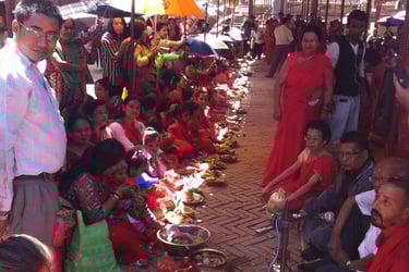
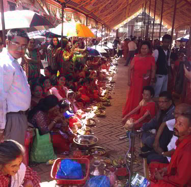
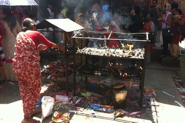
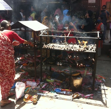
We arrived in Kathmandu, and I immediately fell in love with the Nepalese people, and culture. We had a few days before we were due to hike, so we spent some time enjoying the culture and picking up clothing and supplies for the trip. Kathmandu has everything you’d ever need at a far lower cost than you’d expect to pay, I’d highly recommend purchasing most of your clothing there. We arrived at the Ace office for a briefing the day before we were due to depart. Some advice was given on avoiding altitude sickness “climb slow and drink a lot of water” - at least 3 litres and aiming for 5 litters per day. This is the best advice ‘ve ever heard for high altitude hiking. We were given duffle bags and informed of the weight restriction for the porters carrying our goods. We also opted to rent down jackets and down sleeping bags at a small cost. We went with our guide directly after the meeting to collect our rental gear from a nearby store.
Some photos taken around Kathmandu
Day 1- Arrive in Kathmandu (1,300 m)
The next day we all gathered ready to fly, however monsoon season had decided to hang around longer than it should of, and unfortunately, we weren’t able to fly. There was an alternative helicopter that most of the tour opted for but at an additional cost of $200 USD we decided not to go for this. Most people had to return for work commitments, but we were travelling and didn’t need to rush. We were told to attend the airport, and they’d see when it was possible to fly. Most companies recommended adding a few days as “buffer days” to allow for the possibility of flights being delayed.
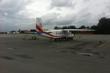
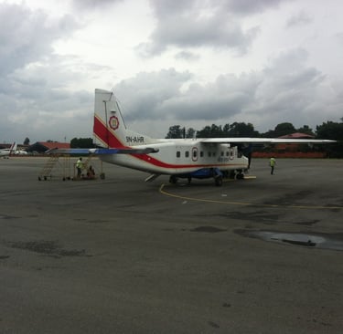
We attended the airport several times over the next 2 and a half days. It wasn’t so bad, we just played Yahtzee on the floor and socialised with other groups. Eventually the weather calmed down and we boarded the flight. The aeroplane was the smallest I’d ever been on, holding only about 12 people. The pilot explained I may not be possible to land but they will attempt and return if it isn’t possible. The aeroplane got very close to the mountains on the short trip, I found it all very exciting. We had a bumpy landing on the tiniest uphill landing strip but no issues, just a scary start to our trip.
The airoplane we flew on, and some views on the way from Lukla
Day 2 – Luka (2,800 m) to Phakding (2,600 m) 7 km | 4-5 hrs
Arriving at Lukla airport was interesting seeing all the porters trying to find people to help for money. We’d already paid but were greeted by our porters who took our bags and showed us the way. I remember noticing the altitude difference as soon as I exited the aeroplane. It wasn’t anything major but it’s worth noting Lukla is approximately 1,300 meters higher than Kathmandu. This is quite a big increase in altitude given there’s no time, your body may need to adjust.
We arrived at the first tea house just before it got dark and met the group, including our guides Bharat and Rabi. Both guides were very good, Rabi didn’t speak a great deal of English, but Bharat was more fluent and took more control. We had some time to brief on safety and what to expect, they also discussed any dietary requirements. From our conversations we’d realised it was in fact two separate tours that had sort of combined as they were both Ace the Himalayas groups. We ate and enjoyed the Nepalese cuisine of dal bhat. I even attempted to eat it with my hands in the traditional manner, this pleased the Nepalese guides but was messy for me.
Although we didn’t get a great deal of time meeting the groups, they all seemed lovely, and a good mix of people from different countries. We were the only British couple, the rest were made up of mainly Australian, and Americans, with a solo traveller from Jordan. There was an American couple, a solo American, and a large group of American healthcare workers. The Australians were all pairs. Two young men, a teacher duo, a teacher couple, and two colleagues (who were becoming a couple)
The next morning, I woke up early and excited. My excitement grew even more when I got my first glimpse of the snow-covered peaks of the Himalayas peeking through the gaps in the trees. I believe I was the first of the tour to be awake and I had a quick wash and brushed my teeth outside. One of the guides Rabi asked me if I’d like a tea, as I’m British we discussed the way Brits typically drink tea and Rabi ensured I had tea just the way I like it every morning. I will always adore him for this.
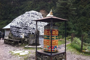
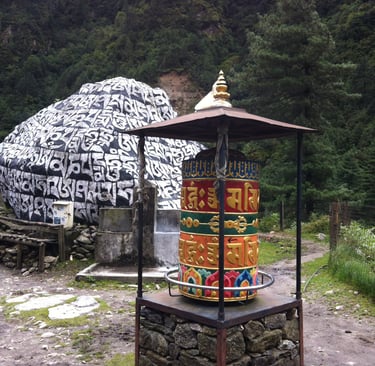
Day-3: Phakding (2,600 m) To Namche Bazaar (3,500 m) 10 km | 7 hrs
The hike began with groups heading off at different paces, as there were several groups it didn’t really matter what pace anyone was gong at. It was explained if you arrive early for lunch you’ll just wait for the others, and if you’re a bit slower it isn’t a huge issue.
The paths are wide, and I got to see some really pretty sights on the way. I also got to climb on the largest rope bridge I’d ever seen. I’d seen them in New Zealand before, but this was very high and had a big drop. The whole area looked wonder, with waterfalls and rivers along the way.
It was quite a long day’s hike with one stop for lunch. The altitude didn’t feel like an issue and the gradient was fair. It wasn’t particularly steep, but 7 hours is quite a long time to hike. As we got close to Namche Bazaar, we stopped so our permits could be checked. The guides took care of this, but we had to stop briefly and wait for our permits to be stamped. The track had become more rural with fewer and fewer tea houses and outhouses to be seen.
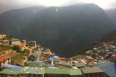
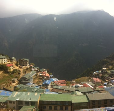
I’d seen a photo of Namche Bazaar that my girlfriend had taken several years before. It looked incredible; I remember thinking I’ve never seen anywhere like it. As I walked around a final bend the town came into view. It was spectacular. I couldn’t believe a town of this size had been built at this altitude and remained so hidden. Namche Bazaar is a large town, and importantly the last place that definitely has electricity, and shops to purchase any equipment. A lady in our group broke her shoe on the way and luckily found a replacement here. It’s a good idea to check you have everything you need before leaving.
Views on the way and from Namche
Day-4: Namche Bazaar (3,500 m) (Rest Day)
This was our first acclimatization day. These are called “rest days” because they’re optional, only two of our group didn’t make the hike because they’d had a bit to drink in Namche the night before.
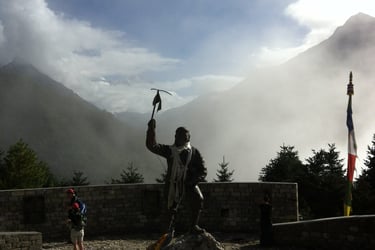
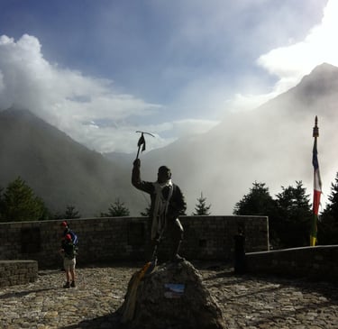
I woke up well rested in a lovely hotel. The hotel had a bathroom so I could wash up before meeting the group for breakfast. The guides explained we’d be hiking to higher ground and visiting a Sherpa museum and the Tenzing memorial statue.
We made our way through the streets of Namche; the people were lovely greeting us with the classic “namaste”. The path quickly became quite steep, at one point I needed to catch my breathe and looked back to see the view of the rooftops of the town. It’s not the most exciting hike so I put my headphones in to listen to some music and drown out the sound of my heavy breathing. By the time we made it to the top I certainly felt like I’d had a good workout.
After a short stop to catch my breath and rehydrate I could see the Tenzing memorial. I wandered over for a better look. It really is a wonderful sight with the backdrop of the Himalayas behind. We sat for a while to enjoy the moment and pay respects. Afterwards we ventured into the museum. It was very informative and great to learn about the culture.
We made our way back to the town. The guides explained when food would be prepared and that we could spend the rest of the day exploring Namche. We returned to Namche, ate some food, had a shower, a little nap, and then pottered around the shops. I bought some yak slippers, they came in handy, and I still have them now.
Later in the evening we were informed a local pub would be showing a movie. The majority of people from our tour attended the movie was called “Sherpa”. I had seen the film before but felt it was a good choice to show visitors hiking the mountain as it inspires respect for the mountains and people who live there.
Tenzing memorial
Day-5: Namche Bazaar (3,500 m) To Tengboche (3,900 m) 11 km | 5-6 hrs
Another solid porridge breakfast, and we said goodbye to Namche. There was a little bit of an incline to begin with but once we were away from Namche it was relatively flat. The altitude was beginning to bother some of the group, I can’t say I noticed anything at this point. The path become narrower, and I noticed a pattern emerging with our group. The American healthcare workers would dart off quickly as if it was a race and others hung back. There’s always a guide at the back anyway so no one can get lost.
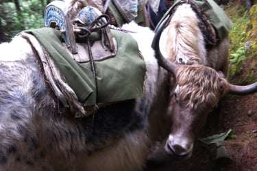
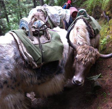
Eventually we reached a point where the fla becomes quite steep and downhill. We made our way down with plenty of stops to allow multiple yaks pass. We also saw some very cute mountain puppies. They loved the attention they were getting from the group.
We stopped for lunch and regrouped. There was a group of Nepalese Police officers completing training. One began to sing, and it was beautiful. I enjoyed the momo’s and the setting very much. Catching up with the team everyone seemed generally okay, except for some people experiencing small headaches from the altitude.
We pushed on, and as we were aware having come downhill for most of the day, we now had to climb quite a lot. We were mentally prepared for this part and found a comfortable pace. We stopped regularly and took in the sights of the peaks through the trees. This is one of two very challenging uphill climbs. After what felt like another day of hiking uphill, we arrived at the Tengboche Monastery. After we regrouped, we entered the Monastery, we were told not o make sounds and simply to spectate and be respectful. When we were sat inside the prayer hall there were multiple monks chanting prayers. It was a highlight of my trip. The day had been difficult, but this cultural treat made up for it instantly.
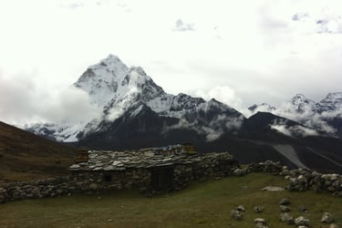
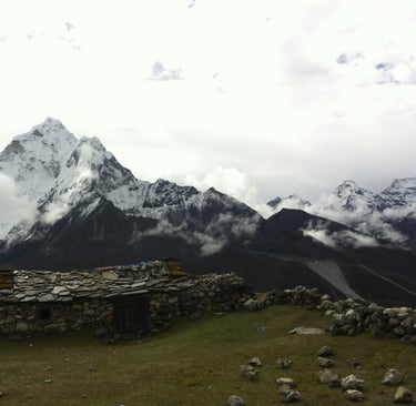
Tight crossings with yaks on the way
Day-6: Tengboche (3,900 m) To Dingboche (4,300 m) 12 km | 6-7 hrs
The morning graced us with a stunning view of the mountains behind the Monastery. It’s worth remembering due to the climate the mountains often disappear behind clouds later in the day. Porridge was a strong choice of breakfast for me. We caught up with the group. Several people were now expressing discomfort mainly from light headaches, but also from a lack of sleep. Some people do seem to have issues sleeping at altitude. The majority however still seemed to be unaffected, and in good spirits. I noticed one of the healthcare workers taking several tablets. I asked what they were all for, he explained one was for energy, the other was for altitude sickness, another for stamina and so on. He told me I should consider taking some. I felt fine so stuck with the advice given by our guides, drink water and walk slow.
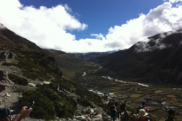
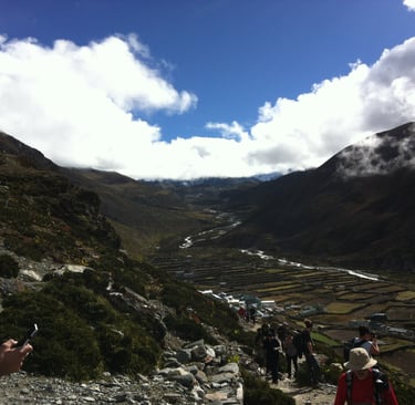
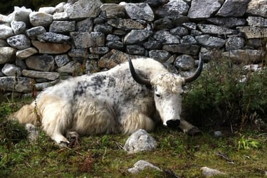
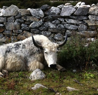
The track begins relatively flat then descends slightly leading into a forest. The trees are magnificent with red and green foliage all around. This area is beautiful with grazing yaks and a rural feel. The trail runs parallel to the river. I noticed the rivers are ferocious here due to it being the end of monsoon season.
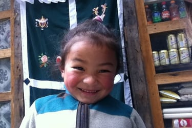
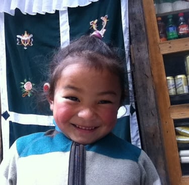
We stopped for lunch and made the usual small talk. I saw some young sherpa children playing which made me smile. The path took more of incline now, and as we proceeded, I noticed the disappearance of the forest and foliage and the landscape becomes more baron. There are some beautiful stone houses in the area, I believe they are farmers accommodation but seemed empty. The wind had picked up and there was definitely a change in temperature.
Dingboche is located on a flat wide area. I was impressed by the size of the town, it’s far bigger than I anticipated. The group was separated into different accommodation for the night. We ate with some of our group and socialised with others. It’s odd that it felt awkward being away from our group, people we had after all only known for a few days.
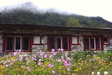
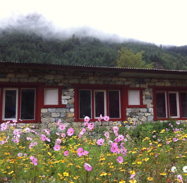
Cute child and a lovely view of the valley
Day-7: Dingboche (4,300 m) (Rest Day)
Another beautiful sunny morning was enjoyed. After washing and eating breakfast I had a good look around outside, the views were really stunning. I could see some of the highest mountains in the world. We caught up with the rest of our tour, and things didn’t seem great with everyone. Most people were now very aware of the altitude, most commonly experiencing headaches, but some also felt very fatigued. Most of the tour decided to stay in Dingboche rather than climb. Oddly the healthcare workers seemed to be affected the worst, maybe all those tablets didn’t work very well.
Our smaller group set off at a much slower pace now. The altitude was affecting oxygen levels, and I think it’s fair to say we all felt like zombies. We hiked in silence for about 15-20 minutes. As we progressed the temperature was noticeably colder. I usually get hot when I hike but my jacket remained on at this point. We took regular rest stops and admired the stupas and prayer flags decorating the valley.
As we approached Nagarjuna the route becomes very steep. Many people seemed to struggle with it, I remember thinking it was probably wise for some of our tour not to join if they weren’t feeling 100%. I had prepared well for the hike physically but did question myself, was I in shape? I looked around to gauge others, and realised it wasn’t just me. It was just a tough climb at high altitude. One foot in front of the other we all gradually made our way to the top.
It was a little cloudy at the top, but we did manage to see some of the great peaks. We made our way back down at pace, no one wanted to hang around. After a nap, and lunch I decided to take a shower, it had been a few days, and my facial hair required some work to. I paid and made my way to the shower. I’m not a fussy person but I was taken back by the fact I could see a flame through the wall when I operated the shower. It was possibly the best shower I have ever had. Having been cold for the majority of the day and frankly quite tired it was a welcome hot shower. I stepped out to find the dining area was full of people. I was only wearing my towel, and I felt quite embarrassed, but I did get a whistle, so it isn’t all bad.
We wanted to explore the valley, a little so we went for a wonder around. Dingboche actually has quite a few eateries, and shops available but what immediately caught our eye was a French Bakery! We bumped into some of our tour which was nice. They told us they felt odd being separated as well, it turns out our group was now in 3 different hotels. I devoured a brownie and another large cake, because I deserved it.
Day-8: Dingboche (4,300 m) To Lobuche (4,900 m) 6 km | 4-5 hrs
Waking up in Dingbouche felt a little different. The altitude definitely had an impact now, it wasn’t severe but it was enough to notice. For me it just felt like a little pressure in my head, sort of like when you have a cold but without the sneezing or coughing.
After breakfast we congregated together as a team again. It was nice to see everyone again. We exchanged hugs and caught up on small talk before setting off for Lobuche. The team’s mild sicknesses seemed to have eased with no one appearing any worse than before.
The track begins relatively flat, it was a nice way to wake up. We passed a lot of stone buildings again and saw lots of yaks. The environment was changing once again as we gradually made our way upwards. The vegetation reduced and was replaced by a lot of rocks. The only consistent vegetation was junipers, the berries from which smelt amazing. The trail itself is less easy to make out, it looks less used. There’s less buildings, and facilities, it has a more remote and basic feel to it.
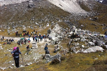
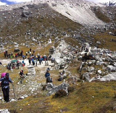
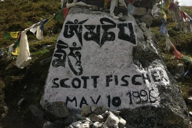
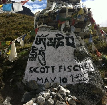
We eventually arrived at the foot of memorial hill. This area is where you pay your respects to climbers that lost their lives in the Himalayas. We spent rested here and spent some time quietly taking the area in. In time we made our way up the hill. I’m not usually put off by large hills, but I was taken back by the size of it. There was no getting around it this was going to be work. The hill is made up of large rocks that act like steps and steps are my enemy. I was often concerned about suffering an injury as my knees have caused me issues in the past. Everyone took several breaks as we made our way up the hill, no one talked, it was challenging.
Continuing mainly flat after the hill we found ourselves at our lunch stop. I believe the small town is the last stop for some time. It was busy but people weren’t really stopping long here. I assume because there’s fewer places so seating would be challenging.
Several hours later we arrived at Lobuche, another small town with a friendly atmosphere. We finished the night off socialising, playing spoons and card games. This was the first night I wore my down jacket. We’d all become quite close. It didn’t feel like we were where we were at all, it just felt like hanging out with friends.
The track and Scott Fischer memorial
Day-9: Lobuche (4,900 m) To Gorakshep (5,200 m) 6 km | 3-4 hrs
It’s only a few hours, it’s only a few hundred meters increase in altitude, so why is it so hard? Altitude, that’s why. At this altitude everything feels more demanding than usual, poor oxygen levels mean your body is working a lot harder. I believe your oxygen levels are around 55% of what they would be at sea level here. There isn’t anything you can do except plod along slower and be patient.
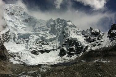
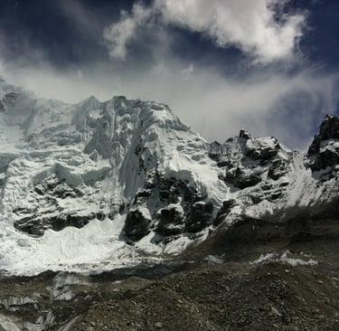
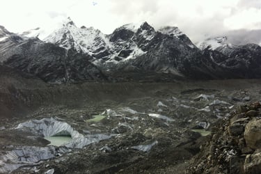
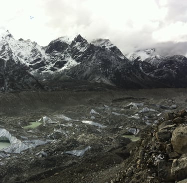
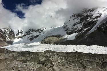
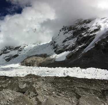
The trail took us along the Khumbu glacier, it didn’t look like the glaciers I’d seen in New Zealand. It looked dark like mud rather than ice. I enjoyed hearing avalanches in the distance. These occurred every few minutes. The views were stunning to, Rabi showed us the peaks of Pumori and Kala Patthar.
The trail becomes more and more rocky and eventually it is just medium sized dusty rocks. Lots of tripping over was noted but nothing major. We passed a helipad and were informed this was the last place helicopter rescue was possible. My partner smiled as we passed, this was as far as she’d gotten last time, every step now is progress.
As we approached the end of this short day we noticed light snow under foot. It wasn’t snowing but it had been. My partner was very concerned as she’d experienced a lot of snow and had issues previously with a lack of sunglasses. We both had two pairs now, and the snow was only light. We scaled a ridge, and we could see Gorakshep in the distance. My headache was now quite consistent. It was difficult to be positive about the hike whilst not feeling great.
I didn’t expect to be so tired when we arrived at Gorakshep. We laid down for a while before venturing downstairs for some food. The accommodation was very busy, I assume because there’s a lack of other options at this point.
After eating I took a warm tea and went to sit outside. I noticed a cloud above me that didn’t seem to be moving, it puzzled me, at this altitude cloud move fast. I’d been sitting there for 5-10 minutes, and it hadn’t moved an inch. I walked away from the building to get a better view and realised it was the milky way! At this altitude the milky way looked remarkable, I’d never seen it like this. The stars in general looked stunning. I informed some of the others, I didn’t want them to miss out. I then hiked up to the highest point I could away from the buildings and after my sight had adjusted enjoyed the most incredible display of stars I’ve ever witnessed. It’s difficult to explain, I’ve enjoyed the stars for many years but never like that. I stood there for what felt like hours, trying to take pictures that didn’t do it justice. All of those stars twinkling making me feel so small, contrasted by the importance of the hike to me was an odd feeling. This was my highlight of the trip.
Capturing the rural feel of the area
Day 10: Gorakshep (5,200 m) To Everest Base Camp (5,400 m) 3 km away each | 2hrs
Big Day. I woke up very excited and really pumped but also nursing a headache, with some nausea. I could finally understand the issues people had been talking about. I continued my disciplined water regime but refused to take painkillers, for no reason other than being a tough guy. We were informed several of the American healthcare workers had been helicoptered back down following altitude sickness. Although I disagreed with the volume of tablets they were taking and attitude of racing on ahead, I did feel bad for them as they’d gotten so close.
We double checked our gear ensuring we definitely had a spare pair of sunglasses, and hiking poles. The climate was so different, and the group was far quieter now, everyone moving slower, and talking less. Occasionally someone would say something, and it would always be optimistic and remind us all of what we’re doing and how great it is.
We began our hike thinking how easy this would be, it’s only a few hours away and we’d been hiking far greater distances. The path fades away so far in, and becomes more of a rocky scramble, it’s difficult terrain to walk on with a lot of slips noted. It’s quite easy to fall here. Everyone adopted a slow comfortable pace. I found it difficult to use my poles because they were getting caught in the large rocks. I kept one in my hand to balance occasionally.
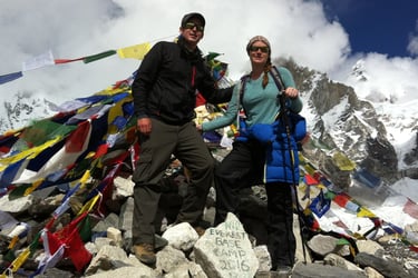
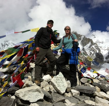
Finally, I could see EBC! It was still quite far down a large hill I didn’t look forward to climbing back up but there it was. I saw a man who I’d talked to earlier in the trip sitting down, he’d been hiking with his daughter, but she had gone on ahead. I asked if he was, okay? He said “I’m okay! I was concerned for him, and not in a rush so I sat next to him and took a rest to. I asked why his daughter wasn’t waiting for him, he mentioned he wasn’t going to finish. I was shocked EBC was 5 minutes away! It’s hard to get your head around it but it really was tough going, and most people were stopping before completing the last part. To give some perspective the oxygen level at this point is about 50% and we’d been hiking everyday for 10 days. It is actually understandable that you could see the end but not feel it’s possible. After telling him my opinion that he didn’t ask for several times he agreed to try after he’s rested.
We made our way down, as we approached, I could see my girlfriend’s eyes watering, she’d attempted this years before and had been helicoptered away. I knew this would be a great moment for her and already had my GoPro ready. I recorded the moment and caught up with our tour. We had group and single photos, and all congratulated each other. The chap I’d seen sitting with moments before eventually came and hugged me. I can’t express the feeling of sitting where so few have been, or so many greats have passed through. The view of the Khumbu Icefall, and the sound of avalanches in the distance, and the sense of achievement was all beautiful.
I didn’t particularly enjoy our hike back to Gorakshep. The path is exactly the same path we arrived on, challenging ground with less energy and purpose. My only real desire was to get back eat and have a nap. I also thought about telling everyone I knew but there’s a lack of signal. Wi-Fi is available at a cost, but I actually quite enjoyed the trip connection free. The thought of giving up crossed my mind. Although a helicopter isn’t possible; I believe it is possible to get a horse to take you to lower ground. The thought of sitting on a horse felt nice but I wouldn’t have felt I’d entirely completed the hike without returning on my feet.
We all made it back to Gorakshep. After a nap we met up and enjoyed food together, but everyone was very tired or suffering now. We all had an early night.
Photos that don’t do the views justice
Day-11: Gorakshep (5,200 m) To Pangboche (3,900 m) 19 km | 7-8 hrs
Leaving Gorakshep was lovely. Someone once told me climbing a mountain is like knitting a jumper and coming down is like unravelling it. The guides told me at breakfast that as soon as we reduce our altitude the sickness will disappear very quickly. We were reducing several thousand meters today.
My girlfriend was overwhelmed with enthusiasm as we made our way downhill. This is historically where my knee cause issues so I was less enthusiastic about the pace she was declining. An injury now would be less problematic, but still problematic.
I regretted not taking more photos on the way up because getting back was far far quicker and there wasn’t much time to stop. We passed through the areas that had caused us so much difficulty on the way up with ease. I particularly recall passing people on their way up monument hill, an area I had found challenging. I of course let them pass and smiled. It is by the way an unspoken rule to allow people climbing to pass when you’re descending.
Several hours in we stopped for lunch. Most eateries have a toilet close by, so far I hadn’t experienced a particularly bad toilet however that all changed here. I won’t be to graphic but I needed a number 1 and it was difficult to perform my number 1 as the hole intended for both 1 and 2’s was overflowing in a sort of cone shape poking out of the hole in the ground. I opted for a light lunch after that. The other hikers mentioned immediately feeling better with symptoms reduced, however I still had a headache. The man from Jordan in our team was struggling having injured his knee going downhill to fast.
I treated myself to another shower and a hot water shave. It felt great to be clean again. Later that evening we all grouped together again. The remaining Americans from the healthcare group were now more engaging with the rest of us.
Day-12: Pangboche (3,900 m) To Namche Bazaar (3,500 m) 14 km | 6-7 hrs
Waking up early was just a standard at this point, along with my standard porridge breakfast. The track was a little up and down at points as we followed the track along the river. Some children appeared at one point saying “hello”, they were adorable.
Shortly before lunch we encountered our first and only rain shower, it hit hard but it was fairly warm. At least I got to use my lightweight waterproofs that I had been carrying for days without any use.
We stopped for lunch, and everyone seemed to be in high spirits with almost all signs of altitude issues gone. I think I was the exception to the rule here because I still felt almost the same as I did in Gorakshep.
The return to Namche was a welcome feeling. We knew we didn’t have much further to go and it felt like a return to some civilisation. My signal kicked in and I really enjoyed the supportive messages I’d received from my family. My girlfriend finally got signal and had 86 likes and 13 comments which is quite an achievement and what it’s all about really. The remaining healthcare workers had decided to make their way directly to Lukla to try to get an earlier flight.
Later in the evening the atmosphere was pleasant. We discussed our last day of hiking together the following day. The whole team was feeling better with the exception of the man from Jordan whose knee was getting increasingly worse. We played chess and I even treated myself to a beer. That’s the first alcoholic drink I had consumed since we began.
Day-13: Namche Bazaar 3,500 m To Lukla (2,800 m) | 16 km | 7-8 hrs
It felt oddly sad to be on our last day trekking together. In such a short time we had formed friendships, learnt about one another, shared stories, and witnessed one another’s vulnerabilities. This day felt like more of a goodbye than a challenge. We’d pretty much completed the challenge now.
The path is much the same but far quicker. I tried to take everything in and appreciate it all. No headphones, no distractions. I tried to stop as often as possible to take photos. Throughout the hike we had been hiking fairly separately. There wasn’t any rush so we all just found our pace breaking into couples and occasionally hiking with others for short times. On the way back to Lukla we were all closer, chatting with one another. Two of the young Australian men talked their porters into letting them carry their own bags. They did surprisingly well I thought.
We met up for our final dinner together. We exchanged a lot of hugs and congratulated one another. The porters and guides were with us to. It was great to see the porters, we rarely got to see them during the trek as they go ahead much earlier. We had previously discussed leaving a tip as a group to be shared between porters and guides. This became a little uncomfortable as some people wanted to be more generous than others. When some tried to explain they didn’t necessarily have the same circumstances some of the group mentioned how hard the guides and porters had worked. For us it was tricky because technically we’d already paid for tips t be included but were happy to tip some money anyway. It isn’t that we didn’t feel the guides and porters worked hard but more so that our circumstances were different along with others in the group. We hadn’t taken a holiday and were expected back at work, we only had our savings for our long way home trip that we were only halfway through. We concluded we’d all put in a hat what we felt we could afford without looking at one another’s sums.
Day-14: Lukla to Kathmandu
We returned to Katmnandu without any issues, and our tour price included a stay at a hotel. It was very hot; we turned the air conditioning on immediately having spent 2 weeks in far colder conditions.
After resting we went to find the burger I’d been craving for almost 2 weeks. Perfection isn’t found in the quality of the product, or the service, or the company. It’s found in the discipline of waiting. I have never enjoyed a burger more.
We’d arranged to meet up with our guides and enjoy a meal. It was really lovely seeing our guides outside of their work. They really were wonderful people and created such wonderful memories.
My girlfriend at the time is now my wife. We talk about the trip often. When I call it the trip of a lifetime I mean it, the stars, the people, the views, and the culture make it incredibly special and rewarding. I haven’t included everything in this post because I believe some things are better learning for yourself. Visit Nepal.
A quick guide to preparing for Everest Base Camp below;
Financial
The tour I purchased included food, and drinks. In most cases you are expected to pay as you go. Some people choose to tip guides, and people serving food along the way, but this is by no means expected.
You should allow for tips on the final evening. This can be shared between the guides and porters. We gave around £30 each.
You should carry additional money to allow for snacking, and showers. All of the prices increase as you ascend but generally a snack was around £1, and a shower was £3.
Food/Drink
It is recommended for westerners not to eat meat during the trip. This is because there is electricity and therefore meat is not commonly refrigerated. Remember if you become sick at high altitude, you’d need to consume a lot more water and achieving 4-5 litres is already challenging to consume. Your risk of experiencing altitude sickness is therefore a lot higher.
I ate porridge for breakfast every day, and mostly vegetable Momo’s and Dal Bhat. I didn’t experience any issues.
I took a small number of snacks like chocolates. There are many stores on the way, and you won’t go hungry as you’re eating 3 meals a day anyway.
Altitude
Acclimatise as much as possible. On our hike there were 3 “rest days”. Although acclimatising is optional, it has been proven to help with the experience of altitude sickness.
Stay hydrated, drink plenty of water. It can be challenging to consume up to 5 litres of water per day but doing so will help. I devised a method for this using water treatment tablets. Details below.
Bottle 1 – Consume 1 litre with breakfast, when empty refill and pop a tablet in.
Bottle 2 – Already clean, consume during hike before lunch. Refill and pop a tablet in at lunch.
Bottle 3 – Consume 1 litre at lunch, when empty refill and pop a tablet in.
Bottle 1 – Now ready to consume on the hike before dinner.
Bottle 2 – Consumed with dinner, refill bottles 1 and 2 and pop tablets in.
Bottle 3 – Consume throughout the evening.
I repeated this daily to reduce costs. The cost of water increases as you ascend. On one occasion the water was a little murky but the guide had it filtered for us. Technically there shouldn’t be an issue with murky water anyway. Iodine tablets kill all bacteria. I didn’t have any issues using water treatment tablets. This method ensured I carried limited water on the hike.
Walk slowly. It really isn’t a race. There is unfortunately an element of competitiveness at times, but other members of the group should be understanding that their pace isn’t the pace. People like to take their time, and you don’t really have anything to do when the hiking is over anyway.
Cultural
Be interested and ask questions
Avoid being rude, you may have an alternate view on religious beliefs but that’s not why you’re there.
You will be expected to carry your own day bag including water and snacks. This should weight around 10kg’s, but it is your preference. Anything else will in most cases be carried for you by a porter. The porters should not be expected to carry over 30kg.
Final Note
Nepal has some fantastic mountains, but there’s so much more to see. The Kathmandu valley is truly beautiful, with many hikes in surrounding areas. Consider adding as much time as possible to visit as much as possible. We were lucky enough to see the Kumari (living goddess) and visit more rural areas outside of Kathmandu when we visited. Nepal is very safe, and the culture is welcoming and generous.